Nearmap Case Study: From Aerial Imagery to a Full-Stack Property Intelligence Platform

Synopsis
Nearmap’s journey reflects a steady shift from local aerial imagery provider to a global geospatial intelligence platform. Backed by successive capital raises, institutional funding, and private equity acquisition, the company has expanded aggressively across key markets. Its growing population coverage and strategic acquisitions highlight how geospatial data is becoming critical infrastructure across insurance, property, and government sectors.
Nearmap was established in 2007, when aerial photography was mostly static, costly and hard to get. The company was determined to do something about it, and thus made available regularly updated, high resolution images via a web-based service.
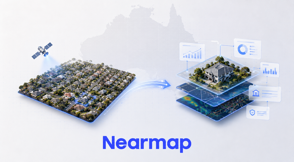
That initial idea has evolved over time into a more comprehensive solution: a system that incorporates both geospatial capture and AI with property data to inform decision-making across multiple industries.
Based in Sydney, Barangaroo, Nearmap currently has operations throughout Australia, the United States, New Zealand and Canada. By 2026 it is supporting over 11,200 organisations around the world, including over 1,500 government agencies.
Stuart Nixon and the Origins of Nearmap
Stuart Nixon is an entrepreneur from Perth, having previously worked in geospatial software, who started Nearmap. Prior to launching Nearmap, Nixon was the founder of ERMapper, a firm specializing in remote sensing technology, acquired by Leica Geosystems in 2007.
After leaving, Nixon saw another potential constraint on the industry: air data was available, but it was too late or too hard to get. Satellite imagery was not always of a high resolution and sometimes hampered by atmospheric conditions, and traditional aerial surveying was not always conducted or was less frequent.
Since this was unacceptable, Nearmap was designed to meet those needs by employing the use of aircraft and provide updated imagery within days through a fast processing pipeline.
In 2008, Nixon sold a majority stake in the company to ASX-listed Ipernica, which was valued at around AUD 16 million. This was done by positioning the company on a public market at an early stage, which would influence the financing of its growth.
From Perth to a Multi-Market Footprint
Nearmap's initial flights were over Perth, testing and refining its capture model. Over the next 10 years, geographic expansion and increased data coverage marked the company's growth.
Nearmap was the sole member of the company to move forward in 2012, when it was relocated to Sydney and became the sole head of its listed company. Two years later, it made its big international debut in the United States. In 2017, it expanded its capture program to New Zealand and started 3D modelling in the major cities of Australia.
Nearmap covers nearly 95% of the population of Australia, 87% of the United States, 75% of New Zealand and 66% of Canada. This growth is part of a consistent trend of transitioning from an imagery provider focused on the domestic market to a geospatial platform provider that provides services to multiple countries.
Engineering Frequency and Resolution
A key difference between Nearmap and the satellite-based data providers is their method of capturing data. The company does not use orbital imagery, but rather its own camera systems on aircraft. This will allow for more detailed and frequent updates, especially in areas with heavy usage like urban areas.
The HyperPod is the core of this system, an array of cameras mounted in pods with several generations of evolution. The HyperCamera 3 (HC3) was launched in the early 2020s to provide oblique imaging, multiple viewing angles for 3D reconstruction and near-infrared imaging for environmental analysis.
Imagery is taken up to six times a year in urban areas with ground sample distances of as low as 4.4 centimetres. The data is processed and delivered in the cloud via a web interface within days, compared with the time typically spent on aerial surveys.
Moving Beyond Imagery
Nearmap started off as an imagery provider but has since added some more data and analysis. It has the ability to present vertical imagery, panoramic images, measurable obliques, 3D models and AI derived insights, which can detect structures, vegetation and changes over time.
These datasets are provided via MapBrowser and enterprising programs such as ArcGIS and Autodesk. Historical imagery archives span time up to 2008 in some areas, enabling users to observe changes over time.
The marriage of imagery and analytics has transformed Nearmap from a data source to a tool for use in operational workflows, especially those where the level of accuracy on individual properties matters.
A Different Capital Path
Nearmap's growth was not typical VC. Following the integration, the company has been funded through public markets to expand operations and technology, but has fallen short in certain areas.Following integration, the company has secured funding from the public markets to grow its operations and technology, but has not done so in all areas.
The following chart shows the capital and ownership timeline.
Capital & Ownership Timeline
| Year | Event | Details |
| 2007 | Founded | Stuart Nixon established the company |
| 2008 | Majority Stake Sale | Sold to Ipernica; valuation at ~AUD 16 million |
| 2016 | Capital Raise | Raised AUD 20 million |
| 2018 | Institutional Placement | Raised USD 70 million (approx. AUD ~700 million equivalent contextually referenced) |
| 2020 | Capital Raise | Raised AUD 90 million |
| 2022 | Acquisition | Acquired by Thoma Bravo for ~AUD 1.055 billion |
| 2023 | Acquisition | Betterview acquisition |
| 2025 | Acquisition | itel acquisition |
Source: Nearmap, PR Newswire, Rask Media
The biggest change was in 2022 with private equity firm Thoma Bravo making an all-cash offer to acquire Nearmap for around AUD 1.055 billion. The move was revealed in August and made in December, leading to a delisting of Nearmap from the ASX. After the acquisition, Andy Watt, who had been the chief operating officer, became hot-copper (HotCopper) chief executive officer.
The expansion of the insurance and property workflows.Expansion of insurance and property workflows.
Nearmap expanded its operations as it began to be run on a private basis and acquired additional businesses to complement the imagery side of the business.
In 2023, the company acquired the Betterview platform, which specializes in the insurance industry's property risk assessment area. The aerial image analysis company Betterview applies computer vision to the analysis of aerial images, allowing insurance companies to evaluate risk and automate underwriting procedures.
In 2025, it was followed by the acquisition of itel, a company offering property claims solutions, which had a platform that incorporated building materials information and pricing and repair-versus-replace analysis tools (PR Newswire). When this data was integrated with Nearmap, the business was expanded to include claims processing and linking imagery to cost validation.
These enhancements placed the company in a larger property intelligence workflow, from underwriting to claims.
Scale and Market Presence
Nearmap has customers in construction, insurance, government, utilities and infrastructure. It currently has over 11,200 customers worldwide including more than 1,500 government agencies.
It still continues to expand its data footprint in critical markets.
Population Coverage by Region (2026)
| Region | Coverage (%) |
| Australia | 95% |
| United States | 87% |
| New Zealand | 75% |
| Canada | 66% |
Source: Wikipedia
The company employs approximately 500 to 600 people across multiple regions (Nearmap; Wikipedia). Its client base includes four of Australia’s top five insurers and all of the country’s top 20 builders, reflecting its penetration into property-related industries.
Reframing the Platform in 2026
In April 2026, Nearmap described its offering as a full-stack location intelligence platform (PR Newswire). This positioning reflects the integration of its core components: proprietary aerial capture, high-resolution imagery, AI-driven analysis, and verified property data.
The platform now connects multiple stages of property-related decision-making, from initial assessment to risk evaluation and claims validation. This shift marks a departure from its origins as an imagery provider toward a system designed to support operational decisions across sectors where spatial accuracy and timeliness are critical.
FAQs
Q1. What does Nearmap do?
Nearmap provides high-resolution aerial imagery and geospatial data used by industries like insurance, construction, and government.
Q2. Who owns Nearmap in 2026?
Nearmap is owned by Thoma Bravo, following its acquisition in 2022.
Q3. Which markets does Nearmap operate in?
Nearmap operates across Australia, the United States, New Zealand, and Canada with varying levels of population coverage.
Follow Inspirepreneur Magazine for daily global business news.
Pooja Malik is a business journalist with over six years of experience covering startups, entrepreneurship, and emerging trends. She has previously worked with leading media platforms such as YourStory Media and BW BusinessWorld, where she reported on business, policy, and market developments. Currently, she serves as Editor at The Inspirepreneur Magazine, where she writes and edits stories across business, lifestyle, and travel, with a focus on clarity, accuracy, and reader relevance.
You Might Also Like

US President Trump Refuses to Restart Trade Negotiations with Canada

The Subtle Power of Spaces: How Architecture Influences Culture, Behavior, and Business
